New closure area includes portion of Metolius Basin
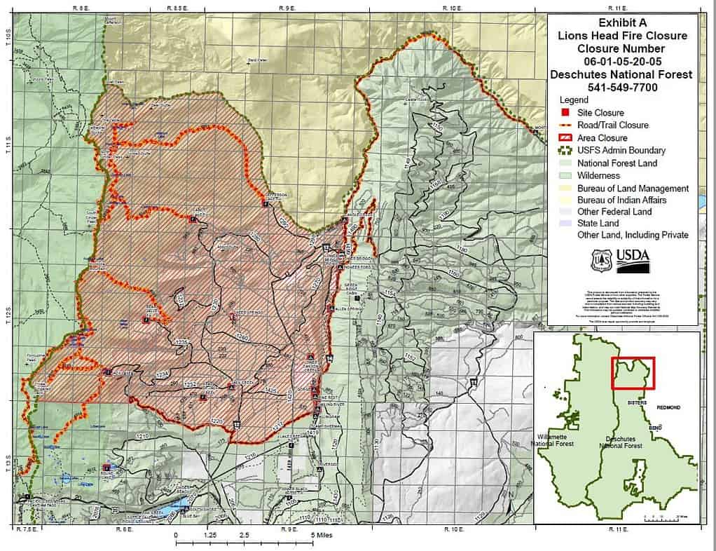
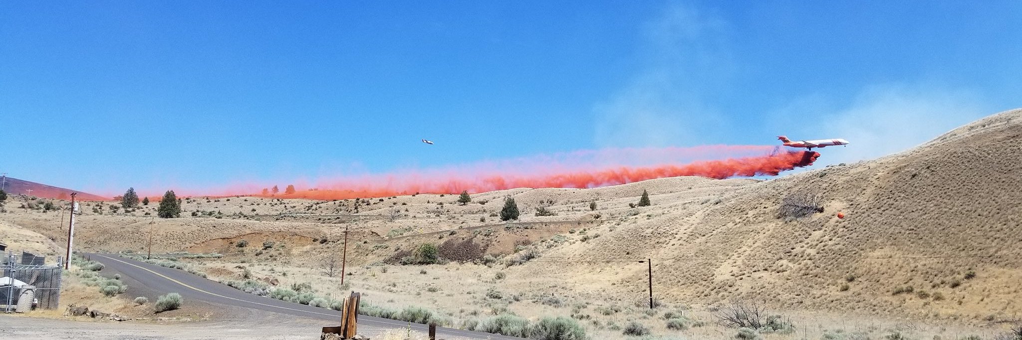
Sisters, Ore.- Effective immediately, the Sisters Ranger District on the Deschutes National Forest is implementing an increased area closure due to the Lionshead Fire’s very active fire behavior.
The closure area boundaries are as follows (see attached map for more information):
Northern Closure Boundary
From the boundary between the Willamette National Forest, the Deschutes National Forest, and the Warm Springs Indian Reservation (T 11S, R 8E, Section 5) near Goat Peak, heading east and including all lands south of Warm Springs Indian Reservation boundary, to the intersection of Forest System Road (FSR) 1400 (T 11S, R 9E, Section 35)
Eastern Closure Boundary
From the junction of the Warm Springs Indian Reservations and FSR 1400 (T 11S, R 9E, Section 35) south along FSR 1400 including FSR 1400, all lands west of FSR 1400 to the intersection of FSR 1247 (T 13S, R 9E, Section 3)
Southern Closure Boundary
From the intersection of FSR 1400 and FSR 1217 (T 13S, R 9E, Section 3) heading west and all lands north of FSR 1247 including FSR 1247, to the junction FSR 1247 with FSR 1200 (T 13S, R 9E, Section 7) then north on FSR 1200 to the junction of FSR 1220, then heading west and all lands north of FSR 1220 including 1220 to the northern boundary of Section 4 (T 13S, R 0E), then heading west and all lands north of the Section 4 boundary to the Willamette National Forest (T 12S, R 7E, Section 36)
Western Closure Boundary
From the intersection of the northern boundary of Section 4 (T 13S, R 0E) with the Willamette National Forest boundary, south of Three Finger Jack including all lands east of the Willamette National Forest boundary including the Pacific Crest trail 2000 until the junction of the Willamette National Forest boundary, Deschutes National Forest boundary, and Warm Springs Indian Reservation boundary (T 11S, R 8E, Section 5)
Campgrounds
Within this closure area, the following campgrounds are now closed: Candle Creek, Lower Bridge, Pioneer Ford, Allen Springs, Canyon Creek, Lower Canyon Creek, Gorge, Pine Rest, Smiling River, Jack Creek, Jack Lake, Abbot Creek and Sheep Springs Horse Camp.
Developed Recreation Sites
The following developed recreation sites are now closed: Jefferson Lake Trailhead, Cabot Lake Trailhead, Brush Creek Trailhead, Bear Valley Trailhead, Rock Pile Lake Trailhead, Jack Lake Trailhead, Head of Jack Creek Trailhead and Lower Bridge Picnic Area.
Trails
In addition to all trails within the closure area, the following trails are also closed: Old Summit trail 4014 north of Booth Lake (T 13S, R 8 E, Section 7), Shut In trail 4019 and the Pacific Crest Trail for the entire length within the Mount Jefferson Wilderness on the Deschutes National Forest.
Roads
All roads within the closure area are closed, including: FSR 1490 from the junction of FSR 1400 to the junction with FSR 1140, FSR 1400 north from the junction with FSR 1120 to the junction with FSR 1499, FSR 1499, FSR 6400 (SW Montgomery Road) from trail 4019 to the Monty Campground, FSR 1217, FSR 1200 from the junction of FSR 1217 to the north and FSR 1220.
Visitors should abide by this closure to avoid potential injury and create unnecessary risk to others. The closure will remain in place until the wildfire is no longer a threat to these areas.
Individuals concerned about the large smoke column in the Sisters and Camp Sherman area should be assured that the Green Ridge Fire remains 100% contained and all smoke is from the Lionshead Fire.
To view the signed closure order, visit: https://www.fs.usda.gov/alerts/deschutes/alerts-notices/?aid=61470

For information on the Lionshead Fire, please go to https://inciweb.nwcg.gov/incident/7049/ .
###


