Central Oregon — Today firefighters will continue fire suppression work on the Round Mountain, Wickiup and Red Fires burning on the Deschutes National Forest.
The Round Mountain and Wickiup Fires are burning approximately seven miles northwest of La Pine and just north of Wickiup Reservoir. The Central Oregon Type 3 Team took command of the fires this morning at 6 a.m. and are now managing both incidents under the name Round Mountain Fire.
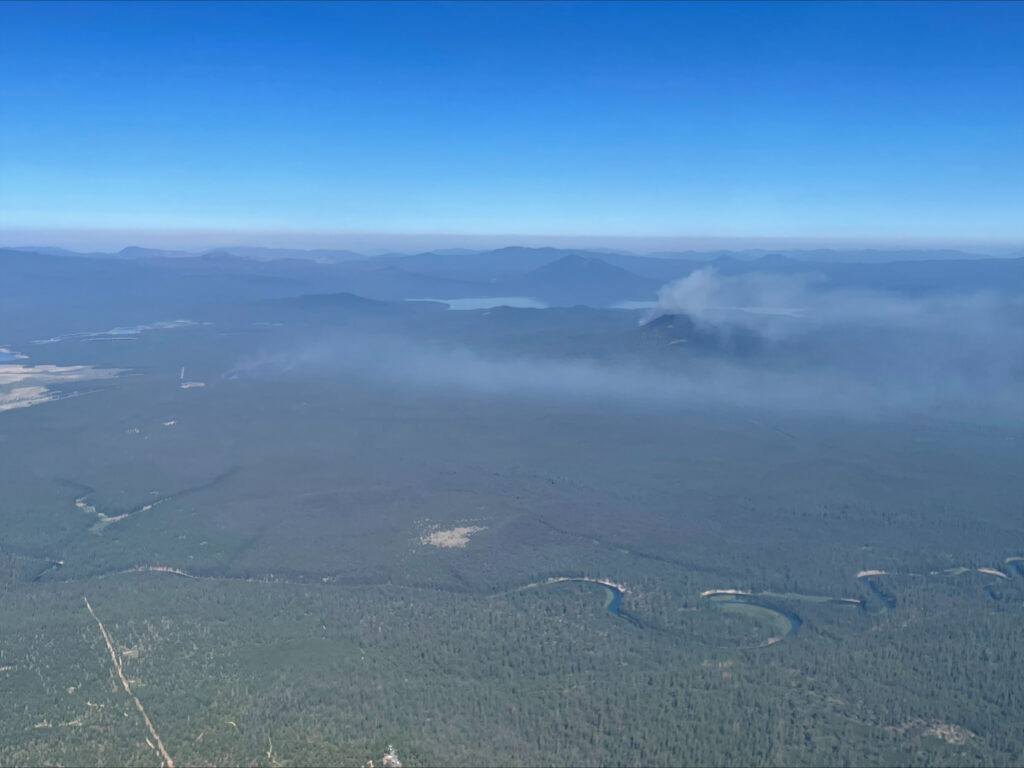
Last night, firefighters worked through the night to construct dozer line around the entire perimeter of the Wickiup Fire. Today firefighters will continue to secure the established line and search for potential spots outside of existing lines. The Wickiup Fire is currently mapped at 135 acres and is 0% contained.
Firefighters were successful in constructing line around 75% of the Round Mountain Fire yesterday and are focused on completing line construction around the perimeter today. The Round Mountain Fire is currently mapped at 20 acres and is 0% contained.
Resources on scene of both incidents include engines, crews, dozers and overhead resources. Yesterday firefighters on the ground were supported by aerial resources include air attack, 6 single engine air tankers (SEATs) and a Type 1 helicopter. Today aerial resources will be available again with air attack and a Type 1 helicopter reporting to the incident this morning. Both fires are under investigation.
The Deschutes County Sheriff’s Office has issued Level 3 (Go Now), Level 2 (Get Set) and Level 1 (Be Ready) evacuation notices north of Wickiup Reservoir. An interactive map of evacuations is available here:
- Level 3 (Go Now): National Forest area north of Wickiup, Forest Service Road 4262 and Forest Service Road 4380 and south of Forest Service Road 42 (South Century Drive)
- Level 2 (Be Set): National Forest area between Road 4380 and the Deschutes River including Bull Bend and Wyeth Campgrounds and private inholdings along the west side of the river at Haner Park
- Level 1 (Be Ready): Haner Park subdivision east of the Deschutes River
Forest Service Roads 4380, 4260 and 4262 in the vicinity of the Wickiup Fire, are currently barricaded for public and firefighter safety during active fire suppression activities. Forest Service Roads 42 and 43 remain open; however, the public is asked to use caution as firefighters and firefighting traffic is present. The Gull Point and South Twin Lakes areas remain open. Bull Bend and Wyeth Campgrounds are currently closed. North Twin Lake Campground remains closed and is being used to support firefighting operations.
The Red Fire, also burning on the Deschutes National Forest, is in the Diamond Peak Wilderness located in steep terrain northwest of Crescent Lake near Redtop Mountain. Smokejumpers and fire bosses (single engine scoopers) responded yesterday. The fire is currently estimated at about 60 acres. A Type 3 incident management team will assume command of the fire tomorrow at 6 a.m.
Visit the official source for wildfire information in Central Oregon at centraloregonfire.org for wildfire updates or follow fire information on X/Twitter @CentralORfire. Call 9-1-1 to report a wildfire.
# # #