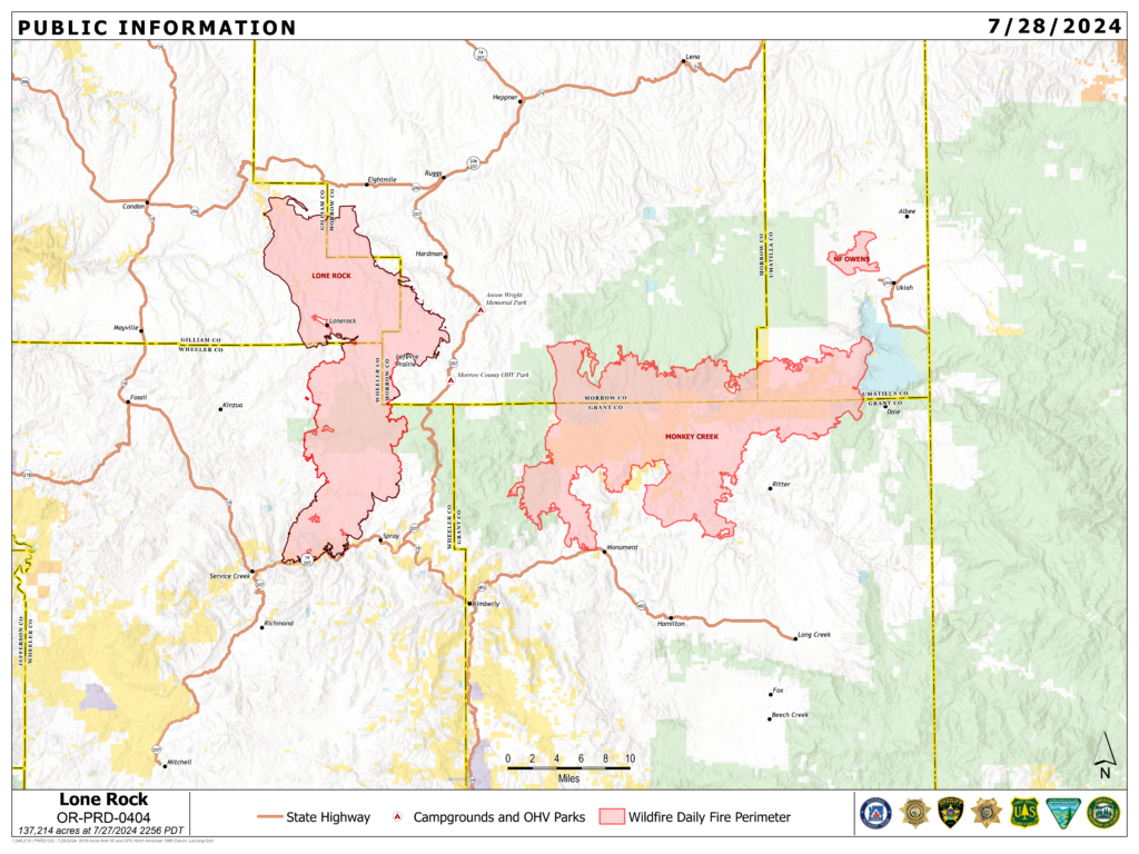
Location: Lonerock, Ore. to west of Highway 207| Size: 137,214 acres | Containment: 73% | Cause: Under Investigation | Start Date: July 13, 2024 | Total Personnel: 766
InciWeb: https://inciweb.wildfire.gov/incident-information/orprd-lone-rock-fire
Fire Information Line: 541-208-4369 | Email: [email protected]
Condon, Ore. — The Lone Rock Fire is being managed under a full suppression strategy by Northwest Incident Management Team 2 (NW2).
Yesterday’s Activities: A dedicated crew continued work on hazard tree mitigation along Forest Service Road (FSR) 25 yesterday. Containment lines continued to hold well, and fire behavior was minimal. There are still areas within the fire’s perimeter that will continue to smolder, burn, and smoke. Some isolated single tree torching within the burned area was observed. This fire behavior was expected and should not pose a risk to existing containment as it is within a previously burned area.
A smaller contingent of firefighters continued to work through the night to patrol the fire perimeter and ensure lines continue to hold, focusing on a few limited areas that were still holding heat.
As more containment is added to the fireline, and the threat to public and private land is further reduced, resources will be gradually reassigned to assist with other fires throughout the region.
Today’s Activities: Even as more containment lines continue to be added, firefighters remain fully engaged and committed to addressing remaining areas of concern, as well as continuing to patrol the fire perimeter. On the west side of the fire, crews will focus on timbered areas north of FSR 25, as well as continuing work in the Alder Creek and Notch Road areas.
On the east side of the fire, crews will continue cleanup work near Flatiron Spring and mopping up interior pockets of heat. Chipping of downed trees will also be occurring in the area, specifically along main travel corridors. Crews will begin the process of hauling out equipment that is no longer being utilized, so that it can be refurbished and sent to support other fires in the area.
Evacuations:
- For Gilliam County evacuation information, visit Gilliam County Sheriff’s Office Facebook page.
- For Wheeler County evacuation information, visit Wheeler County Sheriff’s Office Facebook page.
- For Morrow County evacuation information, visit Morrow County Sheriff’s Office Facebook page.
Closures:
- For updated road closure information, visit https://www.tripcheck.com/.
- Umatilla National Forest Order Number 06-14-02-24-02 includes prohibitions within the Heppner Ranger District on the Umatilla National Forest.
- Bureau of Land Management (BLM) Prineville District Office issued an Emergency Public Land Closure on BLM-managed lands along the main stem John Day River and along the North Fork John Day River from Kimberly, Ore. to Dale, Ore.
- Weather: A weak marine push will result in a bump up in relative humidity to the upper teens or lower 20s on Sunday. Skies will be mostly sunny with haze and smoke. Temperatures will remain steady in the 80s, and winds will pick up again late in the afternoon on Sunday out of the west-northwest. Wind speeds are forecast to be 5-9 mph with gusts around 15-18 mph along ridge tops.
Smoke Information: Visit https://fire.airnow.gov/ for local air quality information.
Flight Restrictions: A Temporary Flight Restriction (TFR) is in place above the Lone Rock Fire area.