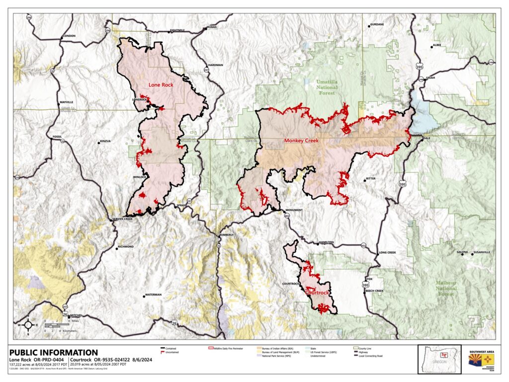
Acres: 137,222 acres | Start Date: July 13, 2024 | Cause: Under Investigation | Fuels: Timber, Understory, Grass | Containment: 92% | Resources: 286
Crews again assist with new area fires. Evacuations levels lowered.
Highlight: Today, additional crews from the Lone Rock Fire were sent to assist local agencies with nearby fires caused by Sunday night’s severe thunderstorm. Cooperation and sharing of resources when possible is essential to control wildfires before they become catastrophic.
Additionally, all evacuation levels associated with the Lone Rock Fire have been reduced to level 1 (Be Ready). See the interactive evacuation map by following the QR code link below. Threats to public safety continue to be minimized due to ongoing work securing and mopping-up of containment lines on the entire fire’s edge.
Overview: Though assisting local agencies with a multitude of new fire starts has become a priority, there is still good work being done on the Lone Rock Fire. Crews there will remain focused on further securing the line and adding containment to the fire’s perimeter. Short sections are still being secured on the east side of the fire west of Henry Creek, and in timbered lands on the west side of the fire. Resources will continue to secure, mop-up, and patrol along completed fire lines. Additionally, back hauling of equipment will continue today, as well as repair work on infrastructure damaged during firefighting efforts.
Weather: Temperatures will be similar or slightly cooler than Monday, mid-80s to mid-90s across the fire area. Calm winds out of the north/northwest are expected, with ridgeline gusts from 15-20 mph. No significant weather concerns are forecast.
Closures:
- Umatilla National Forest Order Number 06-14-02-24-02 includes prohibitions within the Heppner Ranger District on the Umatilla National Forest.
- Bureau of Land Management (BLM) Prineville District Office issued an Emergency Public Land Closure on BLM-managed lands along the main stem John Day River and along the North Fork John Day River from Kimberly, Ore. to Dale, Ore.
Fire Information: 541-208-4369 from 8 A.M. to 8 P.M. – [email protected]
InciWeb: https://inciweb.wildfire.gov/inciden…/orprd-lone-rock-fire
Facebook: https://www.facebook.com/LoneRockFireInformation