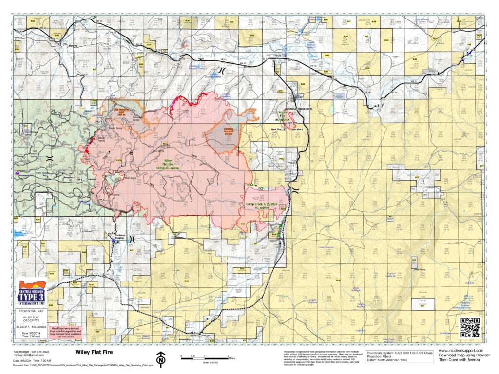
Acres: 15,962 Acres; 0% Contained
Location: 10 Miles southeast of Post off Highway 380
Start Date: September 2,2024 Personnel: 160 Cause: Lightning
Resources: 7 crews | 6 engines | 4 water tenders | 1 skidgine | 8 dozers
Highlights: California Complex Incident Management Team 1 will assume command of the Wiley Flat Fire tomorrow, with an in-briefing scheduled for 3 p.m. today.
Yesterday, firefighters prioritized structure protection, utilizing both aerial and ground resources to scout potential control line locations around the fire’s perimeter. Crews successfully established and anchored lines on the west side of the fire, setting a foundation for containment.
Today, operations on the north side of the fire will focus on completing and securing the established fire lines while scouting for opportunities to use a direct approach against the fire. On the south side, firefighters will continue to complete and hold fire lines around private properties while looking for indirect firefighting opportunities to contain the fire’s spread.
With extreme fire behavior expected today, the public should anticipate seeing heavy smoke and visible smoke columns throughout the region. Firefighters remain prepared to adjust strategies as needed to maintain safety.
Weather: A heat advisory is in place. The high today is 96 degrees, with Southeast winds of 3 to 6 miles per hour and a minimum humidity of 5 to 10 percent.
More Information:
InciWeb: https://inciweb.wildfire.gov/incident-information/orocf-wiley-flat
Facebook: https://www.facebook.com/profile.php?id=61565121969460
Evacuations: The Crook County Sheriff’s Office has issued Level 3 (GO NOW) evacuation orders for areas from SE Pine Creek Road (FS RD 17) east to SE Camp Creek Road, and from Paulina Highway south to the southernmost portion of SE Camp Creek Road, including SE Tackman Road and Antelope Reservoir. Residents in these areas should evacuate immediately. Additionally, Level 2 (BE SET) evacuation orders cover SE Camp Creek Road east to the south fork Crooked River and south to GI Ranch Road.
For the most current evacuation information, please visit the Crook County Sheriff’s Office webpage and Facebook Page.
Closures: Both the Ochoco National Forest and BLM have implemented partial closures due to the fire. For more details and closure maps, visit the Ochoco National Forest and BLM webpages.
Importance of Fire Prevention: All public lands in Central Oregon, including the Ochoco National Forest, are in Stage 2 Public Use (Fire) Restrictions. All open fires, including woodstoves and charcoal briquette fires, are prohibited. In times of high fire danger, it is crucial for everyone to follow prevention measures to avoid additional strain on overburdened resources.
Visit the official source for wildfire information in Central Oregon at centraloregonfire.org for wildfire updates or follow fire information on X/Twitter @CentralORfire. Call 9-1-1 to report a wildfire.
# # #